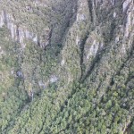
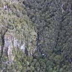
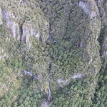
From Jame Scholtok via KiwiCanyon Facebook page;
“Today (13/12/2017) was my birthday 🙂 and last week decided it was time for Me and the boys should celebrate in style with a first ever canyon descent of Johnstone creek off Mt Richmond. We meet at my house at 6am this morning and packed the last of our gear and 200m of rope and made our way to 88 valley and Reid Helicopters. At 8 am we stood just of the summit of Mt Richmond looking down Johnstone creek and watched the cooper fly off out of site. 13 hours later, 20 plus bolts drilled in to solid rock on the face of three 120m waterfalls and some smaller ones. We safely made it back to the car and Eva waiting for us at the end of the northbank road. Me and the team are totally stoked that we pulled this off and did not spend a night in a canyon. This is definitely a birthday I will never forget. Topo pics and video to come. It’s also well worth a trip 🙂 def not for the faint hearted.”
More info in a local news article; http://nelsonweekly.co.nz/2018/01/local-lads-set-canyon-record/


Location
Johnston Creek, Richmond Ranges.
Character
Low flow canyon with big open and clean abseils. Mostly open and easy going with steep sidewalls in a few spots. Overall a lot of effort rewarded by several decent abseils. challenging physically!
Map
?
Approach by Car
Drive down North Bank road and turn right on to Te Rou Road (DoC Mt Richmond track sign)
You could also do a short car shuttle starting the walk at the end of Richmond Saddle road and finishing at Te Rou Road. This reduces the walk in time to approximately 5 and half hours.
Approach on Foot
From the car park walk up the Mt Richmond track to Mt Fell hut (?? Hours). Walk towards Mt Richmond and turn left into the basin before making your way up to the summit (approximately 500m before the summit) . The creek and canyon flow out at the bottom of this basin. After the canyon follow the Mt Richmond track back to car park.
If doing the car shuttle walk up Mount Richmond Saddle track pass Richmond Saddle hut to the top of Mt Richmond and down to the start of the canyon.
Probably best to stay in one of the huts the night before.
Rock:
? Rocky?
Water
Low flow (especially in summer months).
Catchment
Small? Km2?
Anchors
Natural anchors and bolts.
Gear
Minimum of 2 x 70m ropes. (2 x 100 preferably)
Route Description
Just keep heading downward till you hit the track.
Time
Vehicle park to start of canyon
5h30m (or more)
Canyon descent 10hr
Return to vehicle 2h
Total 17h30m (or more)
Flash Flood Danger
Average.
Escapes
Not many and the surrounding terrain is steep with many bluffs.
Notes
First descent: James Scoltock, Neill Molloy, George, Bohdi, Daniel in very low flow. 13/12/2017 Note that the flow in the photos below is probably half normal levels.
Fun to effort ratio: So much effort
Topo:
Entrance
300m boulders
DC 3 of 2m 2m 3m (boulders)
DC 4m (boulders)
DC 6m (boulders)
R1 15m TL Tree (boulders)
DC 4m (boulders)
J 3m or slide 2m (Pool)
R2 4m TL Tree (Pool)
R3 30m X TR (boulders)
R4 65m X TL (boulders) Ledge 15m from bottom
R5 15m TL Boulder (pool)
R6 35m TR Tree (boulders)
R7 90m TR X (ledge on TL @ 70m)
R8 10m TR Tree (boulders)
R9 120m TL X (rebelay TL 5m across 50m down)
150m walk
J 5m (pool)
600m walk
R10 7m TL X (pool)
DC 5m (pool)
40m walk
DC 2m (or jump 4m) (pool)
DC 4m (Log for repel if needed) (boulders)
R11 6m TL X (Pool)
J 4m ( decent pool)
R12 20m TR X (pool 2m down) (decent pool)
R13 6m TR X (Swim Pool)
R14 15m LOG (log downward fall) (pool)
20m walk
Swim
Logs
DC 2m swim
J 1m Swim
100m walk
J 6m or 3m SL (TL) swim pool
DC 5m
DC 5m (log jam)
J 1m (swim pool)
400m Boulder walking out to track